|
The project aims to prepare a Flood Control Master Plan, which would include proposals for all possible flood mitigation measures, by use of hydraulic models and a digital elevation model incorporated into a Geographical Information System (GIS), and taking into account all users of water as well as environmental impacts and social implications.
SRDP provided the following GIS services:
- Development of a geographical database to support flood control studies including updated base maps using satellite imagery and a digital elevation model of the catchment area of Bucayao and Mag-Asawang Tubing Rivers
- GIS and mapping support to the multidisciplinary team
- Technical transfer to local government counterparts
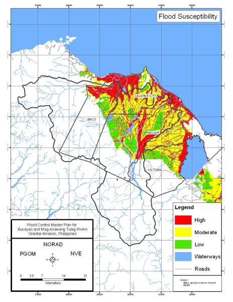
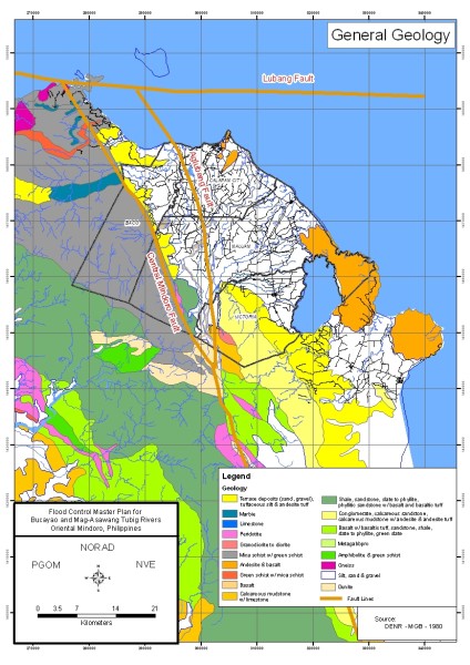
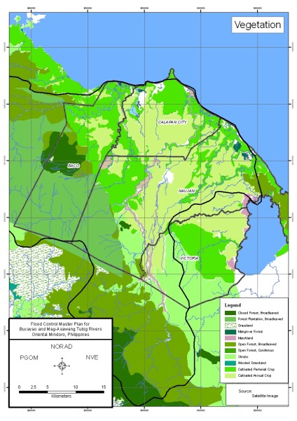
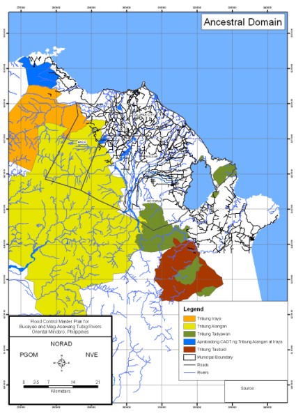
- Production of thematic maps including hazard and risk maps for flood
Sample Outputs:
|