|
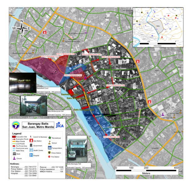
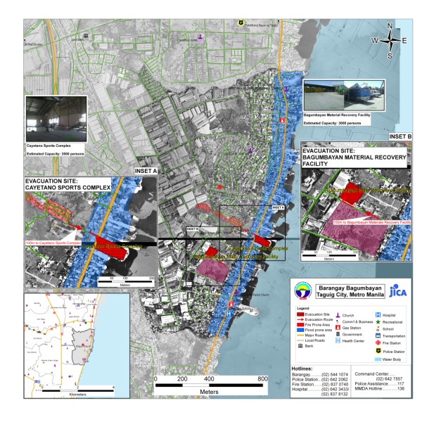
The project aims to produce community level evacuation maps for vulnerable barangays in Metro Manila facing multiple hazards such flood, earthquake and fire.
Aside from the preparation of GIS-based Barangay Disaster Evacuation Area Maps, SRDP participated in public awareness activities and consultation on Disaster Evacuation Areas. Barangay-wide GIS data were also updated through selective ground and structure surveys using Global Positioning System (GPS) equipment and other mapping tools.
Sample Outputs:
|