|
This project aimed to establish a mitigation program to prevent and mitigate damages due to natural disasters through the investigation of urban disaster scenarios in Jakarta Metropolitan Area, and to identify projects which could be possibly financed by JBIC.
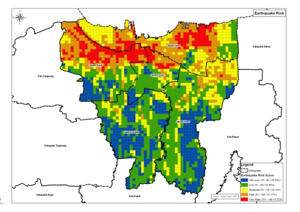
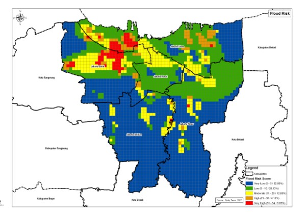
SRDP provided the GIS expertise required to develop a disaster management geographical database and to perform various analysis works for the study area. It provided GIS and mapping support to the multidisciplinary team, e.g., in the conversion of 1:1000/1:5000 Jakarta topographic maps into GIS format, and in the production of thematic maps including hazard and risk maps for flood, tsunami and earthquake.
Sample Outputs:
|